How Will Driving Algorithms Influence Urban Form?

In recent years, private sector companies such as Google, Tesla, and Uber have started to spend vast quantities of time and money on the development of automated vehicles. Though robotic vehicles aren’t a new phenomenon, their deployment onto public roadways is. Use of computer piloted vehicles in resource extraction industries as a cost-cutting measure has been increasing in recent years, but the stakes were lower in places like the Australian Outback, where people and vehicles weren’t sharing a roadway (Diss 2015). With their debut in places like San Francisco, automated vehicles have raised both hopes and questions as they’ve navigated congested roadways with minimal incidents. According to Google’s self-reporting, their vehicles have had 65 incidents as of April 2016 (Google 2016), while having traveled 1.3 million miles (Kalra and Paddock 2016). A high profile death involving Tesla’s autopilot in May 2016 brought a fresh wave of worries regarding the safety of automated vehicles, though it was later revealed that the driver of the Tesla was distracted (Yadron and Tynan 2016).

Regardless of public concern, it is likely a safe assumption that some level of vehicular automation will be rolled out in the coming decade. To what extent the technology will be deployed is up for debate, but it is steadily making its way toward mainstream markets. Self-driving cars will have major impacts on how cities plan for space dedicated to vehicles, particularly parking lots. For example, the city of Temecula, CA requires a minimum parking space to be nine feet wide and eighteen feet long, for a total of 162 square feet per parking space (City of Temecula 2016). Reflect briefly on how many spaces parking lots often contain, and how many hours of the day they are actively being utilized. Land uses dedicated solely to vehicles encourages sprawl and intensifies the scarcity of developable property.

How might automated vehicles alter contemporary thinking and practice in regards to parking? Software, if programmed properly, is highly efficient at allocating resources. In this instance, land itself would be considered the resource, and the software controlling automated vehicles could be the driving force in configuring vehicles in a manner that maximizes use of existing space. Exactly how much space remains an unanswered question, but algorithmic parking could radically alter urban landscapes in the not-too-distant future. Imagine a parking lot where cars are parked centimeters apart rather than inches or feet, where the need for space to swing a car door open is nil.

Thus far, the picture concerning automated vehicles has been painted rosily. Reducing the land area dedicated specifically to parking or driving cars could reduce sprawl, but a more efficient transportation system could end up encouraging the very phenomenon it has the potential to curb – sprawl. Return for a moment to Temecula, a city located only 85 miles from the city synonymous with both sprawl and traffic – Los Angeles. It is important to consider what effect decreased congestion will have on a populace’s behavior. Though it may be difficult to ascertain the exact implications of decreased commuter times on land-use patterns, it is an endeavor critical to proactive planning. It is a distinct possibility that people may move further away from urban cores if it takes less time overall to travel into once-congested areas.

Might automated vehicles, a technology that holds so much promise in reducing impermeable surfaces, indirectly lead to larger urban footprints? Though car manufacturers and planners formulate conjectures as to how people will make use of their automated vehicles, a background in software development has taught me to expect surprises from end users. A certain feature may be intended for use a specific way, but once in possession of those making daily use of a product, unforeseen patterns may begin to emerge. For example, what will stop users from sending level five automated vehicles to pick up groceries ordered online? Or more frivolously, a slushie from the gas station a mile or two away? This technology will alter both where we decide to live and how businesses with their accompanying supply chains function. It is commonly thought that single-occupancy vehicles are detrimental to efficiency, so how will non-occupied vehicles running menial tasks for their owners be viewed?

The impacts of vehicular automation will influence not only housing location decisions and how consumers use their self-driving vehicles, it will fundamentally alter supply chains providing goods and services to buyers. Return to the grocery store example and consider not only the consumer’s choice of sending a vehicle, but also how grocery stores not built for shoppers would operate. These food distributors could be smaller in size than their contemporary counterparts and would have no need of locating in busy, congested central cities. Might total VMT increase as industries like grocery stores move further from the people they have historically co-located near?

Effective transportation and land use policies will be cornerstones in the coming years as metropolitan areas are forced to contend with issues such as global climate change and deteriorating water quality. Planning practices that anticipate future challenges and incorporate emerging technologies such as automated vehicles can help to alleviate or avoid entirely the ever-present threat and practice of unchecked sprawl. It is a battle that will be won or lost in the margins, with victories measured in scales of inches and feet. Though reducing the average size of a parking lot may not seem particularly exciting in practice (because it’s not), the possibilities that arise when more land is available for uses other than car storage are. Vehicular automation, even at the relatively low level of simple parking, can provide massive returns on fostering a more active urban landscape if accounted for early enough.

The Development of the Taipei Metro

Taipei City

Taipei City is the capital in the northern part of Taiwan. By the end of 2015, the population and population density are 2.704 million and 9,951 people per square kilometer respectively (Taipei City Government, 2015). In the 1970s, the economic growth and fast growing population increased traffic congestion. A rapid transit system is a way to relieve traffic congestion problem, reduce air pollution, spur revival town, and develop suburban areas near Taipei City.

The Taipei Metro

The Taipei Metro, started in 1996, is Taiwan first metro system. The system consists of 117 stations and has been expanded to 131.1 kilometers. Five lines connect in a grid shaped network downtown and expand to surrounding suburban areas. The system carries about 1.96 million passenger trips in 2015 (Department of Transportation, 2015). The Taipei Metro offers accessible transfer between routes and other transportation modes such as buses, railways, high-speed rail systems, and an airport. Taipei City is focusing on developing comprehensive public transportation and a user-friendly transportation environment. In 2012, YouBike shared bike system established to provide connections to the Metro and buses in the last mile of popular routes. 30 million people had used YouBike and the total distance of urban bike lanes is about 382.65 kilometers in 2015.

Figure 1. The Taipei Metro Route.

metro-route

Source:http://english.metro.taipei/ct.asp?xItem=1315555&ctNode=70214&mp=122036

It is difficult to obtain land from private owners to construct the Taipei Metro. The Department of Rapid Transit System promoted joint development that buildings integrated with metro construction is co-construction (Department of Transportation). During the process of constructing the Metro system, many high-rise buildings had been built and these buildings contain shopping centers, office space, and hotels. The market value of the buildings is higher than building in other area near the stations because proximity to metro stations causes higher property values due to accessibility and commuting reduction.

Development of underground mall is a method to deal with limited space in Taipei City. Three underground malls (Taipei Metro Mall, East Metro Mall, Zhongshan Metro Mall) connect several Metro stations with parking lot, shopping malls, sport centers, and several other buildings in Taipei City. These underground malls comprise shops and restaurants and provide a convenient way to across the city especially during rainy days.

Impacts

The development of the Taipei Metro brings easy travel and greater prosperity to Taipei City and the surrounding suburbs. The value of real estates near metro stations and transit lines rises after opening of Taipei Metro. The Metro system reduces the travel time between Taipei City and surrounding suburbs. This is leading to population migration from downtown to suburban areas. For instance, the property values within 500 meters around the Nangang Line increases an average 22% before the opening of the line in 2000 and after the opening in 2005 (Chen, 2013). In addition, Taipei Metro is a catalyst for increasing commercial development along the metro lines. For example, Banqiao district is a suburb in New Taipei City, manufacturing industry dominated its economy since 1960s. The Bannan Line opened in 1999 and five stations are located in Banqiao district and that is leading to a commercial growth. Shopping malls, shops, and high-rise buildings for commercial and residential uses are along the metro line in this district. Finally, the Taipei Metro also helps speed up urban renewal in Tamsui, which transformed from a fishing village to a tourist attraction that brings tourists and business investments since the open of Tamsui Line (New Taipei Governement, 2016).

Future development

Taipei Songshan Airport is located at downtown Taipei and served by Songshan Airport Station. A new metro system, Taoyuan Airport Metro, will to open in the end of this year and connects Taipei to Taoyuan International Airport. The new metro is expected to bring 10 million people living in Taipei City, New Taipei, Keelung, Taoyuan, and Yilan closer together in daily life (Taipei City Government, 2015).

Figure 2. Operation of Taipei Metro System.

transit-system

The figure 2 shows the total number of passengers using the Metro system has increased since 2003. Due to the Taipei Metro development, Taipei City has highest number of public transpiration user at 37.4%, and lowest number of private transportation user at 42% in Taiwan. The car usage rate has dropped to below 15%, and the motorcycle usage rate also decrease to 29.6% in 2015 (Department of Transportation). However, motorcycles still are most popular form of private transportation in Taipei because of the their convenience, low cost, and accessibility. Strategies such as building more bike lanes or increasing parking fee for motorcycles may be required to reduce the usage for motorcycles and enhance the transport sustainability in Taipei City.

Figure 3. Motorcycles crowd during rush hour in Taipei, Taiwan.

motor

(Source:http://www.businessinsider.co.id/worst-traffic-jams-around-the-world-2015-12/5/#Um0uh9ZAuxEPUwwH.97)

References

Going Nowhere Fast: High Speed Rail in the United States

Image result for high speed railThe road to high speed rail construction in the United States, if paved with good intentions, is paved even more extensively with regulatory roadblocks, political jockeying, NIMBYism and even economic protectionism.  As Yonah Freemark states in his August 2014 article for CityLab regarding the country’s inability to construct the preeminent transportation mode of our time, “The problem isn’t geography, demographics, or money – it’s federal will.” [3]  Taking into account that the United States espouses a (however indirect) democratic form of government, that lack of federal will is proxy for the lack of will among the American body politic to replace the traffic jams and long airport security lines that we seemingly love to hate.

The (beginning of the) construction of the Eisenhower Interstate Highway System some sixty years ago clearly took place in a different social and political climate than that faced today by its modern day high speed rail (HSR) counterpart.  Perhaps that may be traced to the fact that as more American households came to purchase and rely on personalized automobile transportation, government bodies large and small reflexively collaborated to construct extensive corridors through which these prized and indispensable possessions could be navigated.  HSR, as a more communal form of conveyance (public or not), is the recipient of considerable less advantage.  Only so many Americans rely on rail networks to get to work every day, and one can assume even fewer are able to list an entire railway train as a personal asset.

This form of what may be coined ‘transportation inertia’ is contributing mightily to the snail like pace at which HSR proposals are clearing regulatory obstacles in the United States.  Perhaps the foremost example of such is playing out in Texas, where an increasingly organized group of rural residents, along with many of their locally elected officials, are bringing new meaning to the state’s “Don’t mess with Texas” reputation.  Such an effort concerns the Texas Central Railway, a wholly private LLC seeking to construct a HSR line connecting Dallas and Houston that would achieve the three and one half hour road trip (plus traffic) in under ninety minutes.

Spearheading the crusade is state Rep. Will Metcalf, who has made the (either intentionally misleading or grossly misinformed) proclamation that HSR in the Lone Star State should be stymied simply because it doesn’t cater to cars.  As reported by the Fort Worth Star Telegram in 2015, Metcalf erroneously claimed that the current shortage of roadway capacity necessitated the construction of precisely more such roadways.  (Ask any New York City area driver how that strategy has fared).  As a means of legislative implementation, this bill he introduced “would require the elected officials of every city and county along the route to approve the project,” a deliberate effort to sandbag a route that had even been modified so as to completely sidestep his predominately rural district just north of Houston. [1]

The efforts of Texas politicians to erect barricades on the transportation lad use front have also veered into the sphere of redefining what is constitutionally permissible.  Subsequent to the Metcalf proposal, State Sen. Lois Kolkhorst commandeered an effort to put forth a bill that would inexplicably exclude only HSR projects in the state from using the power of eminent domain. [2] Such a restriction would also be purposefully fatal to the proposed HSR route, which would travel some 250 miles and undoubtedly not be possible without the invocation of eminent domain.  Most glaring about the Texans Against High-Speed Rail
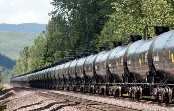
proposed bill, however, is that it seems to disregard (intentionally or not) the scores of other private organizations that do enjoy eminent domain authority in the state, including energy and telecommunication firms, as well as over one dozen railroad companies (which one can only assume are not of the HSR variety). [4]

For an instance in which the regulatory hurdles of implementing HSR are proving not quite as insurmountable, California is the place to be.  After a gaining voter approval from a 2008 Proposition, the state says it is on track to open phase I of its HSR in 2029 (in time for Governor Jerry Brown’s 91st birthday).  There the issue of the HSR that seeks to link the Los Angeles and San Francisco metropolitan areas is also experiencing hiccups on the eminent domain front.  While no elected representatives have been as bold as those in reliably red Texas, Golden State law firms are gearing up for the acquisition of land that will enable California’s HSR to travel in the more arc-like patterns necessary to achieve the projected 220 mph top speed at which the trains are expected to travel.  However, the costs associated with doing so remain the subject of debate, as the geometric compromising of fields often enclosed by right angles results in greater farming costs per acre on the remaining land. [5]

Clearly, the prospects of HSR in the United States are inextricably tied to the degree to which citizens and their representatives in various levels of government “get on board” with the idea.  While the potential benefits of HSR construction are beyond dispute, perhaps what is most needed to assuage the relevant land use impediments are clear, concise, fact-based, public information campaigns that prioritize substance over the needles and reckless flair for the dramatic.  Now if only a certain presidential candidate espoused such a philosophy…

[1] Batheja, Aman. “Lawmaker’s Bill Could Be a Silver Bullet to Stop High-speed Rail.” Fort Worth Star-Telegram, 25 Feb. 2015. Web. 30 Oct. 2016.
[2] Batheja, Aman. “Senate Bill Targeting Bullet Train Project Advances.” The Texas Tribune, 08 Apr. 2015. Web. 30 Oct. 2016.
[3] Freemark, Yonah. “Why Can’t the United States Build a High-Speed Rail System?” CityLab, 13 Aug. 2014. Web. 30 Oct. 2016.
[4] Jaffe, Eric. “Meet the Opposition to Texas High-Speed Rail.” CityLab, 15 Apr. 2015. Web. 30 Oct. 2016.
[5] Sheehan, Tim. “High-Speed Rail Land Use Will Become An Issue In The Central Valley.” The Huffington Post, 26 Dec. 2012. Web. 30 Oct. 2016.

The design of intersections

According to the webpage walkscore.com1, Iowa City is a car-dependent city. Because walking to college is quite normal², this is a surprising result for a college town like Iowa City. Walking in this city can be partly uncomfortable, time-consuming and even almost impossible. As a pedestrian in the city, a really annoying  thing for me is to cross roads especially at intersections. I always have the feeling it takes more time waiting to cross streets than the actual overall walk. That`s why getting a walkable city is not only about a dense and mixed-used development, but also about a design of the built environment which enables and promotes walking. In this spirit it is not only about design on higher scale levels, but also the planning of the use of land on a micro-scale level. In this way, even the appearance of an intersection may have an effect on the travel behavior.

Furthermore, intersection design also has an effect on safety. More than a fifth of all injured pedestrians on US roads are hit at intersections3. There is a connection between traffic light setting and the number of accidents2, so the likelihood to cross at red traffic lights increases enormously after a waiting time longer than 50 seconds4 and some transport users feel even more safe jaywalking than using the provided crossings2. This is problematic because jaywalking and running a red light is more dangerous and one part of designing a walkable city is also to make walking as safe as possible. To prevent dangerous behavior, crossing design should be as convenient as possible. In Iowa City there are places with improvement potential of the design of crossings to promote more walking traffic. I will discuss two examples. The first example seems be convenient, but is still not optimal, and the second one is an extreme example of how planning prevent people from walking, even if the environment is mixed use and has a decent amount of density.

1

Image 1: Intersection Madison St Iowa Ave. (taken 09/15/16)                                         

The first intersection is the junction of Madison St. and Iowa Ave. It is near the Pentacrest downtown and directly within the university campus. On the east  side is a bank and no street. However, pedestrians are able to walk east. Image 1 illustrates the topography of the area with a sharp differentiation Image 1: Intersection Madison St Iowa  of two separate levels. They are connected         via stairways. This can be considered as discriminating because wheelchairs users are not able to use stairways, so this way must be considered as mot handicapped accessible. According to Google Maps, the way for this group to get from Madison St./Iowa Ave. to the Old Capitol Building is more as twice as long as the direct way. For this reason, ramps may be planned in addition to the stairways. Another disabled group which is excluded from using public space on its own in Iowa City are the deaf and hard of hearing. Traffic lights like this one lack acoustic signals to indicate if pedestrians are allowed to walk. Another problem of this traffic light is the setting. There is a high number of pedestrians particularly when university classes start or end, but the setting of the traffic lights does not prioritize pedestrians, so waiting times get too long and     people tend to run red lights. For example, on a Thursday  at 4:55pm the pedestrian light was red and all 21 pedestrians crossed the street.2

Image 2: Pedestrians at the first intersection (Taken 09/15/16)

Nobody waited to get a walking signal. This common behavior also due to the waiting time can lead to a culture of common dangerous crossing behavior. In this way the prioritizing of cars at the setting of the traffic light has two results it promotes jaywalking and makes walking less convenient, so reducing waiting time can be an instrument to promote walking2. Beside reducing waiting time, the usability of crossings for every part of the society needs to be checked and adjusted.

The first example was about problems at crossings of intersection, but in Iowa City are also places which lack official possibilities to cross streets. For example, according to Google Maps Rohret Rd has no crossing for 1.1 miles or busier South Gilbert St near downtown for 0.2 miles. This also pushes people into jaywalking because pedestrians need to cross streets sometimes and due to their low-speed they are pretty sensitive about enlarging the distances from detours. In this way people jaywalk more, get use to this, and see breaking traffic rules and risky behavior as normal. These are examples in which street design makes walking more dangerous but the built environment near the old University of Iowa studio arts building makes walking impossible.

3.png

Image 3: Area around University of Iowa studio arts building (map: Johnson country aerial 2014; Own changes)

The building is near a neighborhood, but walking there is not possible because the traffic lights at multi line highway 1 lack of facilities for pedestrians. In this way, even if people want to walk there, they cannot. In this way car driving is promoted and the use of the other modes of transport are banned.

I provided examples of planning problems in walkability. The examples also show that problems occur even in walkable areas and there is often a possibility to improve. Actually, planning always involves other interests such as bike riders or car drivers which must be taken into account, although a minimum of walkability should be provided and all places should be at least accessible. If a community wants to be more sustainable, creating a walkable environment is a good thing to do. In this way we can develop good planning, which takes walkability into account and results in more pedestrians and has good effects on economy and the community3.

___________________________________________________________________________

1: Walk Score (2016): Living in Iowa City.  http://www.walkscore.com/IA/Iowa_City

2: Pollack, Keshia M, Andrea C Gielen,  Mohd Nasir Mohid Ismail, Molly Mitzner, Michael Wu and Johnatan M Links (2014): Investigating and improving pedestrian safety in an urban environment. Epidemiol. 11(1)

3: Oswald Beiler, Michelle R. and Brian Phillips (2016): Prioritizing Pedestrian Corridors Using Walkabilty Performce Metric and Decision Analysis. Journal of Urban Planning and Development. 142 (1)

4: Forschungsgesellschaft für Straßen- und Verkehrswesen (2015): Richtlinie für Signalanlagen. FGSV. Cologne

A Double Edged Sword: Transportation Demand Management Ordinances

Traffic Congestion on the Golden Gate Bridge

Cities around the nation struggling to relieve congestion are exploring new ways to reduce traffic demand and wean their residents off personal vehicle dependency. San Francisco has recently adopted a number of transportation demand management tactics that aim to do just this. One of these techniques is a transportation demand management ordinance (TDM ordinance) that requires developers to incorporate trip-reducing elements into their future developments. Under this ordinance, those who work or live in a new building will have a number of alternative transportation options or characteristics that encourage less vehicle trips and alternate ways of travel . A possible reduction in current and future congestion or a reduction in fuel consumption and improved air quality are typical motivators for municipalities enforcing a TDM ordinance.[1]

For many cities with TDM ordinances, the regulation only applies to commercial developments but San Francisco has designed their code to apply to all new developments, including residential.[2] The TDM measures San Francisco adopted include a number of incentives as small as improving walking conditions and providing bicycle parking to larger features such as maintaining a shuttle bus service and reducing parking supply. To satisfy the TDM ordinance, developers can apply a combination of measures to earn points based on the intensity and costliness of the measure.[3]

San Francisco's draft TDM menu of options Source: San Francisco Transportation Demand Management Measures

San Francisco’s draft TDM menu of options
Source: San Francisco Transportation Demand Management Measures


In theory, a TDM program would force new developments to be more accommodating to other modes of transportation resulting in less reliance on personal vehicles. The goal of many cities implementing this type of regulation is to make urban areas less car oriented and subsequently, reduce the negative impacts of cars. On the surface, this idea appears to be one that would work well given that developers have limited ways to opt out. However, the newness of this type of ordinance leaves questions about how it will affect the pattern of development, housing prices and the development of new or extended transit systems.

For instance, well-intentioned but burdensome TDM ordinances may push new development to suburbs or other cities where developers can avoid increased development costs that are a result of regulatory requirements. If TDM requirements are too strict, business and residential developments may find that the cost of locating within a city outweighs the benefits. The consequences of this rational can contribute to sprawl and lost tax base for cities. [4]

Furthermore, developers may not be aware of changing consumer demand for transportation alternatives or it is possible that the demand is just not high enough to justify willing or voluntary developer participation in TDM programs. Therefore, developers choose to locate outside of a TDM ordinance municipality because they do not see the benefits of TDM. Given potential resistance from developers, it is important to be cognizant of ordinances that are too strict.

Specific TDM measures, such as reduced parking supply, can appear beneficial to developers but may also have unintended effects. Contra Costa County, CA identifies lower construction and maintenance costs and increased availability of space as benefits for the developer of supplying less parking. Higher density developments or additional building amenities are possible uses of excess space. [5] On-site amenities such as a fitness center, a childcare center or other recreational spaces can also reduce the number of required trips for individuals or households and lessen the need for a personal vehicle.

However, given the still high consumer demand for personal vehicles, developers will no doubt be giving up a profit if they reduce the supply of parking. In order to mitigate lost profit, the price of remaining parking spots and rents in general will likely increase based on implementation of TDM ordinance options. The question then is what does this mean for housing prices, especially in San Francisco where rents are already extremely high?

Families and individuals who value active and public transportations will be willing to pay for alternative transportation options and additional on-site facilities in their housing costs. These families may choose to give up the luxury of multiple cars because other gains in housing amenities. However, low-income households or individuals cannot fiscally value alternate transportation options, which results in overall less housing options and exacerbates affordable housing issues.

The implementation of TDM ordinances may also influence new and existing transit routes. As new developments are built in compliance with a TDM ordinance, the demand for transit in these areas is likely to increase. This will create pockets and corridors of new developments that have residents or workers who are more likely to be reliant on a transit system. The influence that a TDM ordinance has on transit development is another important consideration for cities implementing such an ordinance. Effects of the regulation may require increased investment in a city’s transit system in order to keep up with transit demand.  Increased transit ridership will demonstrate success of the ordinance but a city must also have the funds to expand their system to areas of new development to be completely effective.

When looking to achieve trip reduction, a TDM ordinance seems like a simple code change that is sure to lead to reduced congestion and lessen negative externalities of personal vehicles. However, the additional implications of this policy change can be quite severe and can lead to highly complex issues. Without in-depth exploration of such unanticipated consequences, municipalities with TDM ordinances can end up with more problems than before policy implementation.

[1] Erik Ferguson (1990) Transportation Demand Management Planning, Development, and Implementation, Journal of the American Planning Association, 56:4, 442-456, DOI: 10.1080/01944369008975448

[2] Laura Bliss (2016) Can San Francisco Build Housing That Eases Traffic? The Atlantic City Lab. http://www.citylab.com/commute/2016/09/can-san-francisco-build-housing-that-eases-traffic/500708/

[3] Draft TDM Menu of Options. San Francisco Transportation Demand Management Measures. http://default.sfplanning.org/plans-and-programs/emerging_issues/tsp/tsp_TDM_Menu_Options_v3b_handout.pdf

[4] West Berkeley Circulation Master Plan: Transportation Demand Management Plan Report (2009). Wilbur Smith Associates. http://www.ci.berkeley.ca.us/uploadedFiles/Planning_(new_site_map_walk-through)/Level_3_-_General/TDM%20Report%20Draft%20030309.pdf

[5] Transportation Demand Management Ordinance Guide (2009). Contra Costa County Department of Conservation & Development. pg. 6. http://www.co.contra-costa.ca.us/DocumentCenter/Home/View/3994

The Pipeline Hidden in Plain Sight

OilTrain

A BNSF freight train carrying tank cars back to the Bakken region of North Dakota rolls through Nyack, east of West Glacier, in June. Justin Franz | Flathead Beacon.

Pipelines, and the protests surrounding them, have been getting a lot of attention in the media in recent years. Protestors voicing their opposition have shown up in the news filing suit in court, blocking construction equipment, and chaining themselves to the White House fence. Their arguments against pipelines include concerns about environmental impacts, improper use of eminent domain, and threats to sites held sacred by Native Americans . As these issues are debated in the public arena and addressed by U.S. courts and legislators, transportation planners should be considering another question: How is this oil being transported in the meantime?

This is of particular interest in Iowa, not only because of the protests against the Dakota Access pipeline that have taken place here, but because crude oil extracted from the Bakkan shale formation in North Dakota and southern Canada pass through the state on a daily basis – not by pipeline, but by rail, which has become the chief means of transporting crude oil from the newly developed oil fields in the north to the refineries located in more established oil-producing regions in Texas, Oklahoma, Louisiana.

In fact, from 2008 to 2014, the number of rail cars transporting crude oil in the U.S. grew over 5000 percent, from 9,500 carloads to 493,146.[i] This rapid growth in transportation of crude oil by rail coincides with the surge of production in the Bakkan oil fields, and has resulted in millions of tons of oil freight, as can be seen in the graph below.oilrailfreight


It also has coincided with the increased practice within the rail freight industry of assembling “unit trains,” or trains in which all the cars contain the same product in order to improve transportation efficiency. Unfortunately, in the case of crude oil, this also raises safety concerns, as evidenced by the industry name given to trains transporting much of the crude oil: High-Hazard Flammable Unit Trains or HHFUTs, defined as trains carrying more than 70 carloads of flammable liquid. (In Iowa, in fact, Canadian Pacific Railway reports the average number of cars containing crude oil in its HHFUTs is 115.[ii])

In effect, the rail lines used for this purpose have become de facto pipelines. The irony may be that while protestors are calling attention to the potential environmental impacts of a future pipeline, considerably less public attention is being given to the HHFUTs that may pose current risks. The maps below show the routes used by the two companies currently transporting crude oil through the state, Canadian Pacific Railway and BNSF Railway.canadianpacificcruderoute

bnsfcruderoute


Notably, the Canadian Pacific Line that follows the eastern border of the state passes through the Upper Mississippi National Wildlife and Fish Refuge. This ecologically sensitive area stretches from the northern border of the state to just south of Clinton, Iowa, and serves large numbers of migrating bird species. It also provides drinking water for communities located along the river. The risks of running HHFUTs along this route were made apparent in 2015, when a train carrying ethanol on these tracks partially derailed. Three cars burst into flames, and another three plunged into the river.

As in any instance in which transportation infrastructure is suddenly receiving heavy traffic or being used in a manner for which it may not have been designed, it’s important to ask what structural or safety updates may be required to meet these new demands. A series of high-profile accidents in recent years, including a runaway HHFUT in Quebec that caused 47 deaths and destroyed more than 30 buildings in a downtown area in 2013, spurred government regulators and industry groups to take action. Measures proposed by the Association of American Railroads and later adopted by the U.S. Department of Transportation include:

  • Enhanced design standards for new and existing rail cars, including thicker steel plating and thermal shields
  • Operating speeds reduced to 40 mph within urban areas
  • Increased rail inspections

dot117


Unfortunately, conversion of all rail cars to the new standards will take a number of years to accomplish, and the railroad industry is objecting to the enhanced braking systems also required by the new regulations.[iii] Full adoption of the safety measures may thus be slowed. At the same time, because of the great difficulties in establishing alternate rail routes, changing the surrounding land uses may be the best option for managing the risks – though this can also be a lengthy process, and in the case of sensitive areas like wildlife refuges, altering the land use may neither be desirable nor feasible.

As a result, the difficulty posed by HHFUTs for planner is that there are no short term fixes for this situation. Nonetheless, it is important to give attention to these hazards. The most immediate planning actions may not be in the realm of transportation and land use planning, but in disaster mitigation planning, to ensure that safety measures are being put in place that can be rapidly deployed in the event of an accident. This can include establishing caches of emergency response equipment near sensitive areas.

Planners should also be mindful in formulating emergency response plans that land immediately adjacent to railroads generally carries less value. As a result, occupants of these areas are more likely to be economically disadvantaged than in other, more desirable residential areas – which means, in the event of an accident, they may have limited means to find housing elsewhere. At the same time, if long term plans call for removing homes near railroad lines travelled by HHFUTs to create a safety buffer, it will be important to balance this with plans to create additional affordable housing elsewhere.

Ultimately, it is difficult to say how long the Bakkan oil boom will last or whether proposed pipelines may someday clear construction hurdles and reduce the need for crude oil transport by rail. However, transporting ethanol by rail entails similar risks but has a much more dispersed pattern of transport routes – suggesting these “pipelines” on railroad routes is an issue with which planners in Iowa will need to contend with for the foreseeable future.

[i] Association of American Railroads, “U.S. Crude Oil Rail Traffic,” https://www.aar.org/BackgroundPapers/US%20Rail%20Crude%20Oil%20Traffic.pdf

[ii] Iowa Department of Transportation, “Current Practices in Iowa for Crude by Rail and Ethanol Transportation by Rail,” http://www.iowadot.gov/iowarail/safety/report/9_0_CBR_Biofuels_Rail.pdf

[iii] Association of American Railroads, “Moving Crude Oil Safely by Rail,” https://www.aar.org/BackgroundPapers/Moving%20Crude%20Oil%20Safely%20by%20Rail.pdf